FINANCIAL DISTRICT AND SEAPORT MASTER PLAN
NEW YORK CITY
Preparing Lower Manhattan for 2100, and beyond.
URBAN DESIGN / INFRASTRUCTURE DESIGN / CLIMATE AND TRANSPORTATION PLANNING

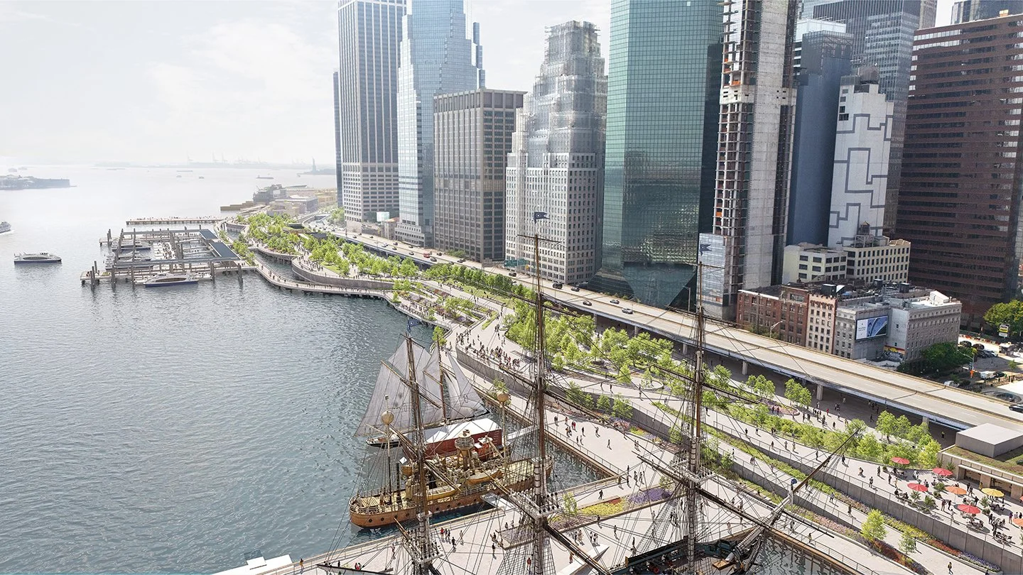
The Financial District-Seaport Climate Resilience Master Plan is the keystone of New York’s Lower Manhattan Coastal Resiliency effort, providing a new vision for the one-mile stretch of shoreline from the Brooklyn Bridge to the Battery, Manhattan’s most vulnerable and valuable waterfront. The shared city-community vision for a resilient 21st-century waterfront embraces an unprecedented opportunity to transform the waterfront to better serve all New Yorkers for generations to come.
masterplan & 30% engineering design completed 2025 // for NYC EDC // with ARCADIS, MNLA, MARVEL, SITEWORKS, AKRF, SIVE PAGET, JK MUIR, ONE URBANISM, BLOOM IMAGES // status ENVIRONMENTAL REVIEW

By the 2040s, tidal flooding and more frequent and severe coastal storms will threaten these historic neighborhoods, internationally recognized symbols of New York City’s dynamism. The dense existing urban fabric — historic landmarks and public open spaces threaded through with significant infrastructure: five subway lines; an elevated highway; a ferry terminal and other maritime connections; a heliport; critical power transmission lines; and sewage management facilities —means that conventional flood defense would wall off the community from the waterfront.

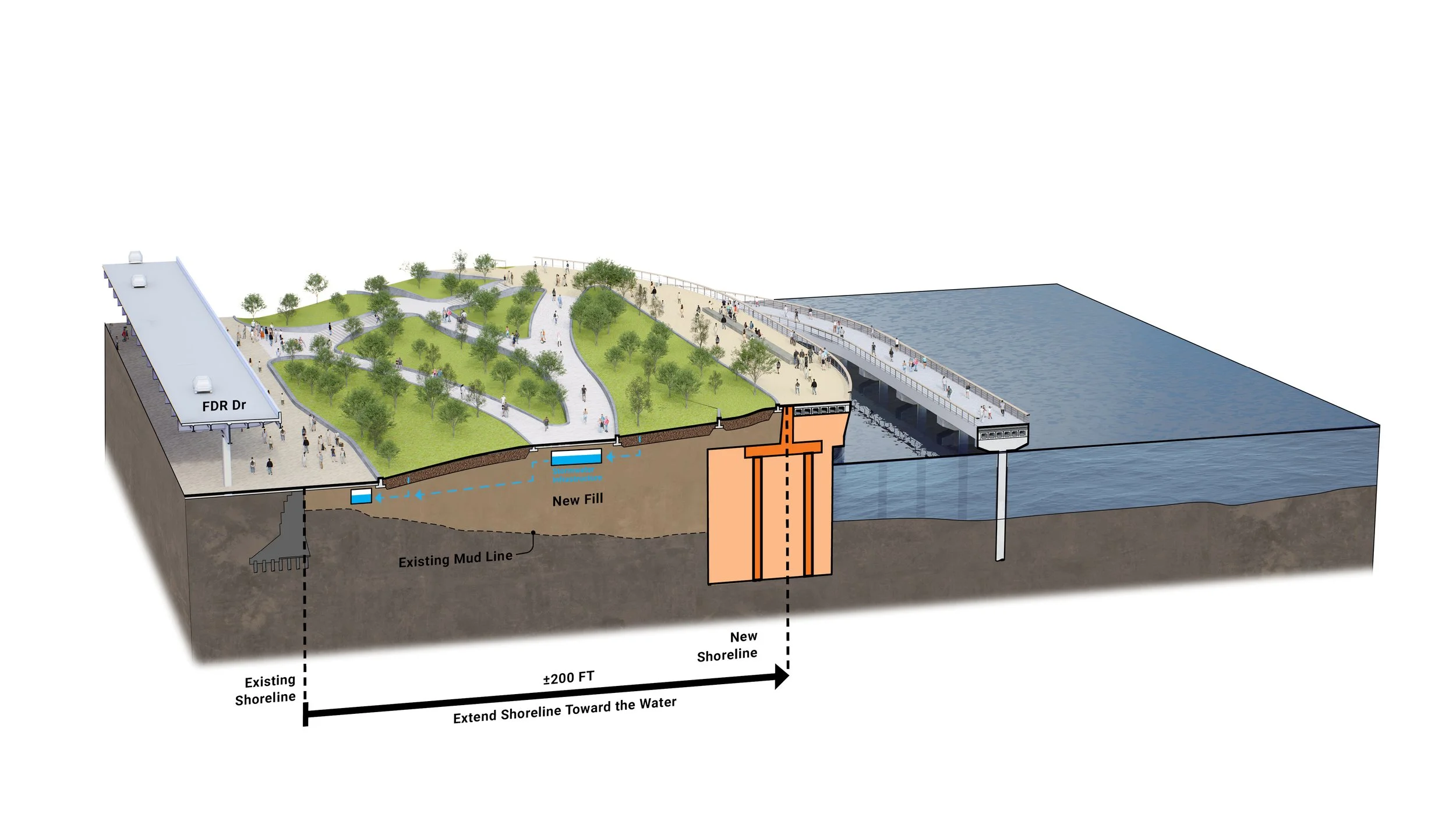
The City's bold approach circumvents this lack of available land by extending the shoreline of Lower Manhattan into the East River with a new multilevel public park. Its upper level conceals floodwalls to protect from coastal storms while adding a constellation of new public spaces with elevated harbor and city views. At the lower level, an esplanade designed to withstand occasional submersion will hover just above the water and connect to new piers and ferry terminals.